Everyone loves exploring a great map. They give us information about our current location, guide us to new places, help us imagine distant cities and inspire us to set off on new journeys.
Modern interactive maps are a game changer, helping us reimagine places within our community and beyond. It's no wonder they are one of the most popular tools for community engagement projects.
The latest update to our District Engage mapping tool bring projects to life, and helps residents visualise how a project will look, and how proposed changes will affect them and their use of a place. It helps citizens to engage with a project and share their thoughts and ideas with the wider community at a time when genuine, authentic engagement with our local communities has never been more important.
Why community engagement matters
While we might be inundated with the constant flow of information and decisions that are made far beyond our control, the simple act of involving local communities in the decisions that shape their future is a positive step that reinforces good governance and creates a shared sense of responsibility.
Community engagement strives to bridge the gap between ordinary people and the government. Whether the intent is to simply inform citizens about issues that affect their lives or empower them with a place at the decision-makers' table, community engagement is most effective when its findings fully reflect the views and opinions of a diverse range of residents.
One of the simplest ways to engage citizens is by using a wide range of digital engagement tools.
The role of digital engagement tools
District Engage offers an comprehensive range of digital community engagement tools including surveys, polls, Q&As, and online discussion threads that help to gauge community sentiment about projects or policies, while giving us access to on-the-ground insights and local know-how. Together with instant analytics and reporting capacity, these tools help to inform and guide decision making and improve project outcomes to better reflect the needs and wants of the community.
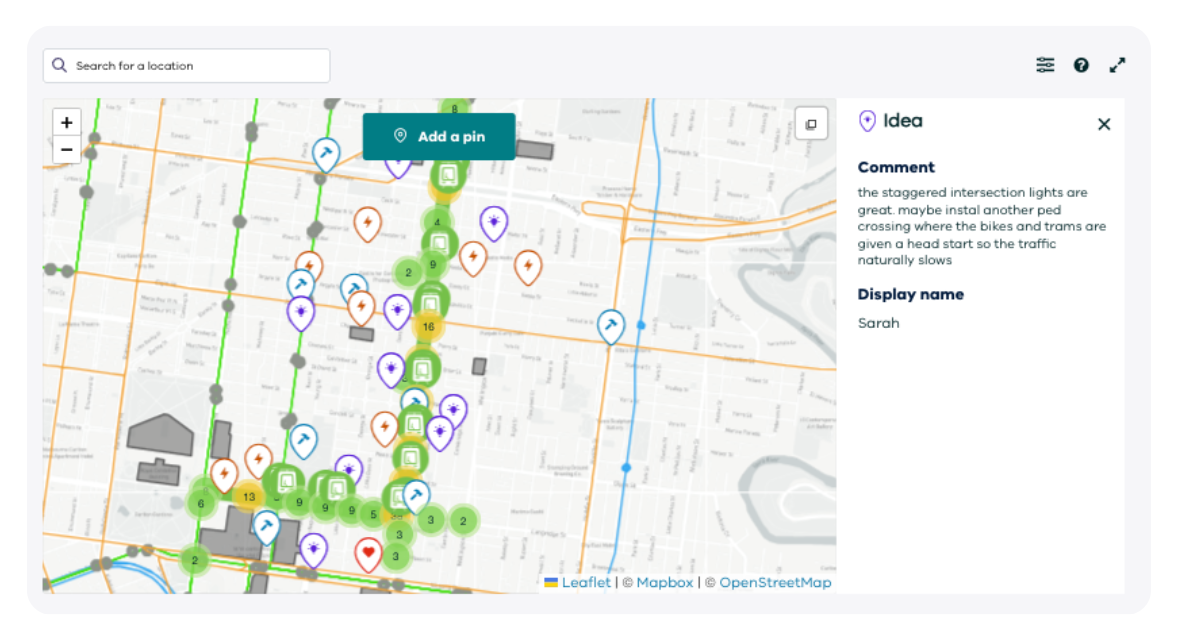
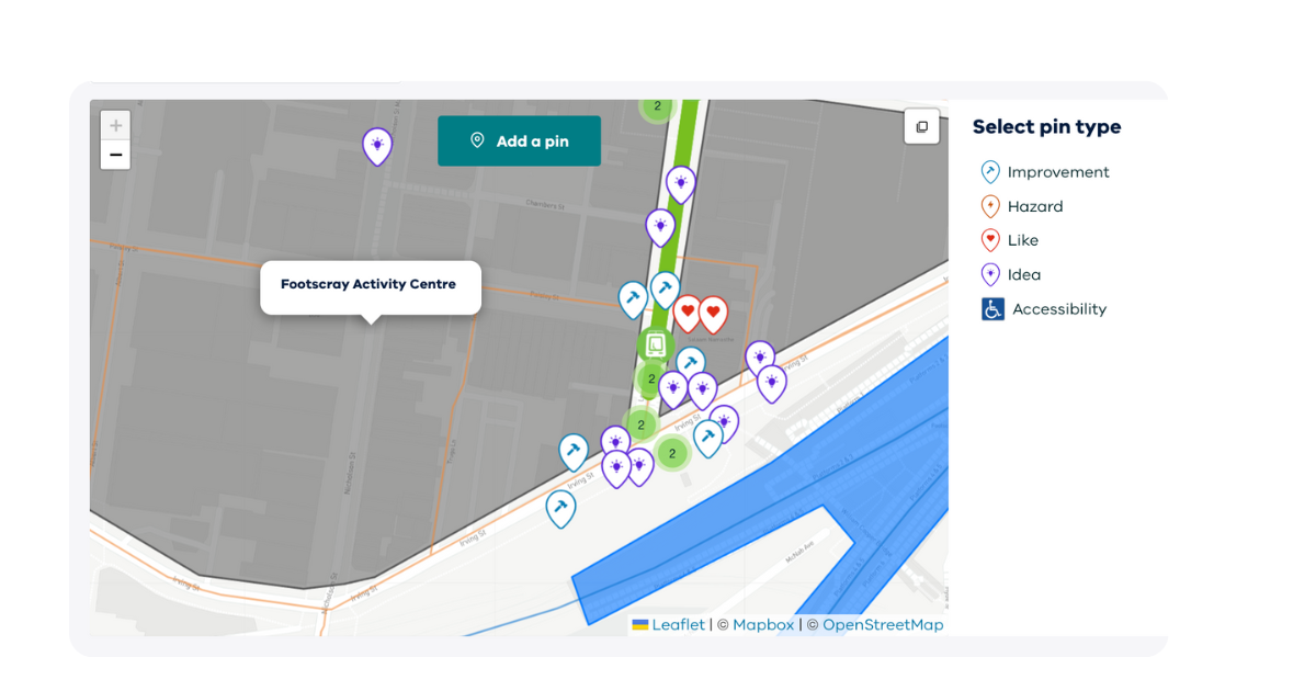
District Engage Mapping Tool
The mapping tool transforms abstract concepts and textual data into an interactive map that lets community members see, understand, and interact with a proposal. The mapping tool has been embraced by our clients, who have utilised its powerful ability to engage their communities and gather insightful on-the-ground local knowledge.
Put it into context
Maps are powerful communication tools that can provide important context that words or numbers can’t easily convey. Our mapping tool lets you pinpoint exactly where issues, ideas, or concerns are relevant to your community. From something simple like a bike path to a controversial proposal for a wind farm, being able to visualise the project on a map can help bring a proposal to life, and help the public (and the decision-makers) better engage with the significance of the project.
Inclusive and accessible
One of the challenges of community engagement is making sure that all voices are heard. Not everyone is comfortable expressing themselves through text or speech, especially when language barriers are an issue. One of the benefits of a mapping tool is that it enables people to easily engage with an issue, simply by pointing to a location on a map. It opens up the dialogue to diverse communities and lets everyone participate.
Maps tell a story
Maps tell stories. They can reveal trends, patterns, and disparities that might go unnoticed in traditional engagement methods. Practitioners can use the mapping tool to create compelling visual narratives that support their community engagement efforts. Whether it's showcasing the impact of a proposed project or highlighting areas that require immediate attention, maps can convey messages with impact.
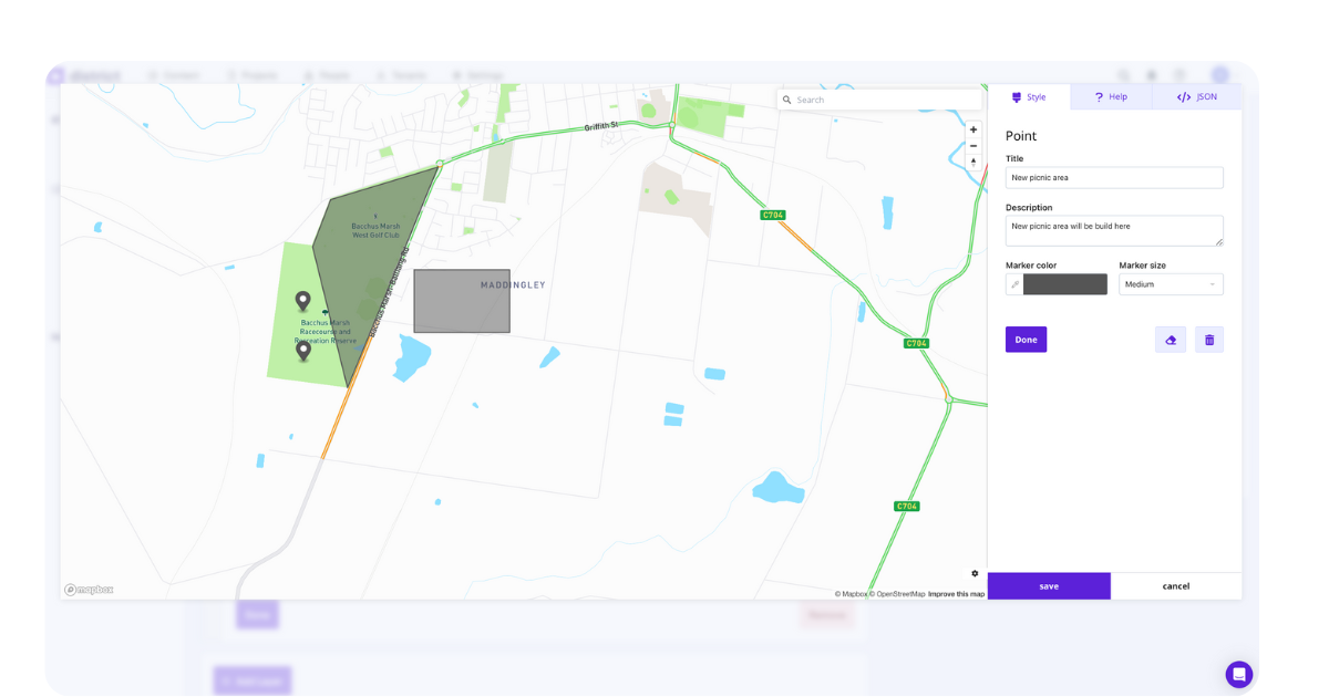
Map builder
With District Engage powerful map builder, you can easily add layers to a map to help tell a story. Layers can transform a map into a timeline of a project, for example, with various stages highlighted in different coloured layers to showcase the progression of the project. Layers can also be used to describe various activities taking place in different sections. Administrators can add pin drops to the map to add information to the story, such as business names, landmarks, or placeholders for proposed actions.
For community engagement practitioners, the key to success is meaningful, inclusive interactions. By providing detailed maps that add geographic context and visual storytelling to a project, District Engage helps practitioners share important information that helps drive impactful and inclusive engagement with the local community.
To find out more about the enhanced features of District Engage, including the features of our mapping tool, schedule a demo today.